
There's a pattern that repeats every rainy season in Bekasi: photos of a flooded living room, a car half-submerged, and comments like "wish I'd known, I wouldn't have bought here." The thing is, most of those events were actually predictable. Flooding rarely arrives out of nowhere — usually the spot already has a history, sits at a low elevation, or has drainage that can't handle a heavy downpour.
So if you're hunting for a flood-free home in Bekasi, the goal isn't to chase a "guaranteed dry" promise from a brochure. The goal is to verify for yourself, with data and field observation, how big the flooding risk really is at the spot you're eyeing. Here are the four things that matter most, plus how to check each one.
Why Flooding in Bekasi Isn't Just About Rain
Bekasi has fairly flat terrain and is crossed by several main channels such as Kali Bekasi and Kali Cikeas. When heavy rain coincides with runoff sent down from the upstream areas (Bogor–Depok), the volume passing through can exceed the channels' capacity. Low-lying pockets and areas with poor drainage are the first to flood.
So this is exactly why it matters to separate "Bekasi" in general from a specific location. Within the same subdistrict, one cluster can stay safe while housing across the street floods regularly — the difference is just a matter of a few tens of centimeters in ground height and how well the channels are maintained. That's why the sweeping "Bekasi floods" line is misleading; what you need to assess is the spot, not the city.
Checklist 1: Measure the Ground Elevation
Elevation (ground height relative to its surroundings) is the most fundamental factor. Water flows to low ground, so a house that sits higher than the road and the land around it has a natural advantage.
The practical way to do it: open Google Earth or a topographic map app, check the elevation figure at the location, then compare it with the surrounding area. If the cluster land sits lower than the main road, that's a question mark. During an on-site tour, notice whether the cluster road surface is higher than the drainage channel, and whether the house floor is raised a few tens of centimeters above the road. In North Bekasi around Jl. Raya Perjuangan, the ground elevation is among the relatively favorable ones compared with several low-lying pockets on the southern side.
Checklist 2: Trace the Flooding History
Historical data is more honest than a marketing claim. Before getting attached to a location, take the time to trace its record from the rainy seasons of previous years.
- Search the housing name or street name on social media and news, paired with the word "flood" or "puddle" — residents' photos and dates are usually more accurate than a brochure.
- Visit the site while it's still the rainy season if you can. Mud marks on fence walls, a waterline on the brickwork, or mossy paving often hint at the height of previous flooding.
- Ask longtime residents, builders, or the nearby stall owner. They know which spots "rise for sure after three hours of rain" and which stay safe.
Because history sticks to a place. If a stretch has flooded badly before, the structural cause (elevation, channels) most likely hasn't changed unless there's been a major infrastructure fix.
Note: this piece is educational, to help with the verification process, not a guarantee about the condition of any location. Flood risk is shaped by rainfall, channel conditions, and upstream factors that can change. Always check the latest conditions on the ground and, if needed, request official data before deciding.
Checklist 3: Inspect the Cluster Drainage System
Good elevation but clogged drainage can still flood. Healthy drainage makes sure rainwater flows out quickly and doesn't pile up inside the complex.
What to look at during the tour
Notice whether each side of the cluster road has a channel (ditch) that's clear, wide, and not blocked by trash. Check whether that channel flows to one main outlet at a lower point — not a dead end. Ask the developer whether the complex has a retention pond, a pump, or recharge wells to hold runoff at peak rain. A cluster designed with integrated drainage usually lists this as part of the infrastructure, not an afterthought.
Checklist 4: Measure Distance and Position Relative to the River
A house near a river does get a view, but the overflow risk is higher if it sits low. What needs assessing isn't just the distance, but also the height difference between the land and the riverbank, plus whether there's an embankment. A house far from the main channel and at a higher elevation has a thicker risk buffer.
| Factor | Safer indication | Watch out for |
|---|---|---|
| Ground elevation | Higher than the road & surrounding area | A basin, lower than the main road |
| Flooding history | No flood traces in recent years | Repeated flood photos/news |
| Cluster drainage | Wide channels, flowing, with recharge/retention | Shallow, clogged, dead-end ditches |
| Distance to river | Far from the main channel, high elevation, embankment present | Right against the riverbank, low land |
These four factors reinforce one another. A spot that clears all four is far more convincing than a location that only leads on one aspect. If you want to understand how new infrastructure projects redraw the risk map and an area's value, we cover it separately in our look at new infrastructure in Bekasi and its impact on property prices.
The North Bekasi and Emerald 70 Context
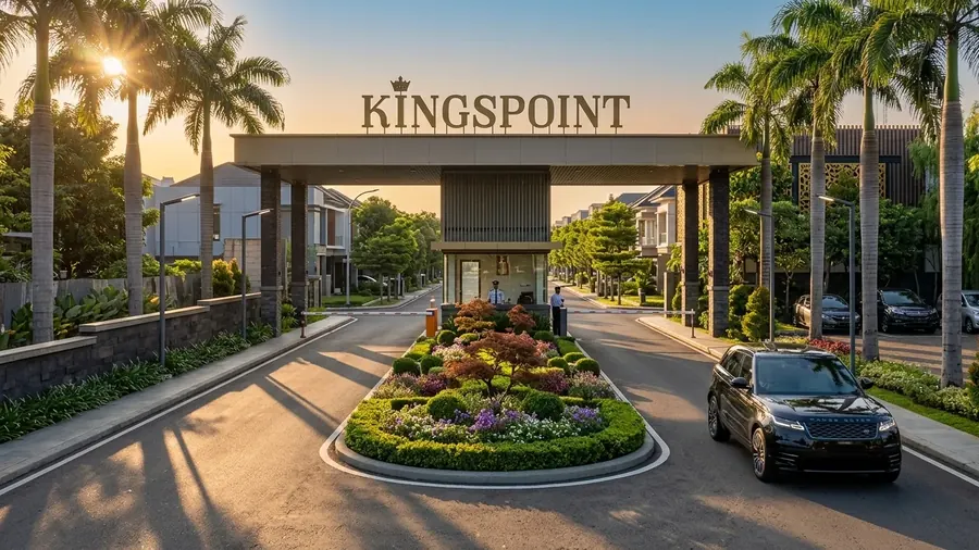
One reason the North Bekasi area around Jl. Raya Perjuangan appeals to young families is the combination of relatively favorable elevation and its access. The Emerald 70 House at Kingspoint Residence by Mandiri Development stands in an area considered flood-free, with a one-gate-system cluster whose drainage is designed to integrate with the area layout. A two-storey home (land area 47.25 m², building area 70 m²) in the Rp700 million range including VAT, with an installment simulation starting around Rp5 million a month.
The location is strategic too — roughly 5 minutes to Stasiun Bekasi and Summarecon Mall Bekasi, 10 minutes to Tol Bekasi Barat, and close to the planned MRT Phase 3 line (Harapan Baru and Karangsatria). Good access and dry land are two things that, put together, make a home calmer to live in over the long run. If you're weighing the value of living near public transit, also check our discussion of Bekasi TOD areas and the benefits of living near public transit.
The point is, choosing a flood-free home comes down to small verification work you do before you sign — check its elevation, trace its history, inspect its channels, measure its distance to the river. Those four steps take a weekend or two, but they save you from a regret that costs far more. If you've already got a spot in North Bekasi in mind, just start with its ground elevation this week.
Want to check Emerald 70's flood history & drainage?
The Kingspoint team can walk you through the land elevation, cluster drainage system, and area history for Emerald 70 in North Bekasi — so you have a clear picture of the risk before you decide.
Chat on WhatsApp Now